


In brief
Access management is a set of strategies designed to prevent traffic congestion, increase pedestrian and traffic safety and, in certain circumstances, preserve scenic views along road corridors. These strategies may also be key elements of comprehensive land use and transportation plans. Communities have a variety of options available when implementing access management.
Summary
Too often, communities grow linearly along a road or highway. As homes, businesses and retail buildings are constructed along the road, there is a corresponding proliferation of driveways and traffic signals. The result is a deterioration of the function of our roads, decreased highway capacity and a corresponding increase in traffic congestion and hazards.
Access management is a means to control the number, design, and location of curb cuts onto a road. In addition to the more obvious connection to safety, function and capacity of a road to handle traffic, access management has a strong influence on land use and the character of a road corridor. In Vermont, access rules are established and administered by state and local governments, depending on the type of highway. Local communities do have the opportunity to influence access-management decisions on state roads through land use regulations, and an understanding of the connection between access and land use is critical to understanding the dynamics of road corridor management.
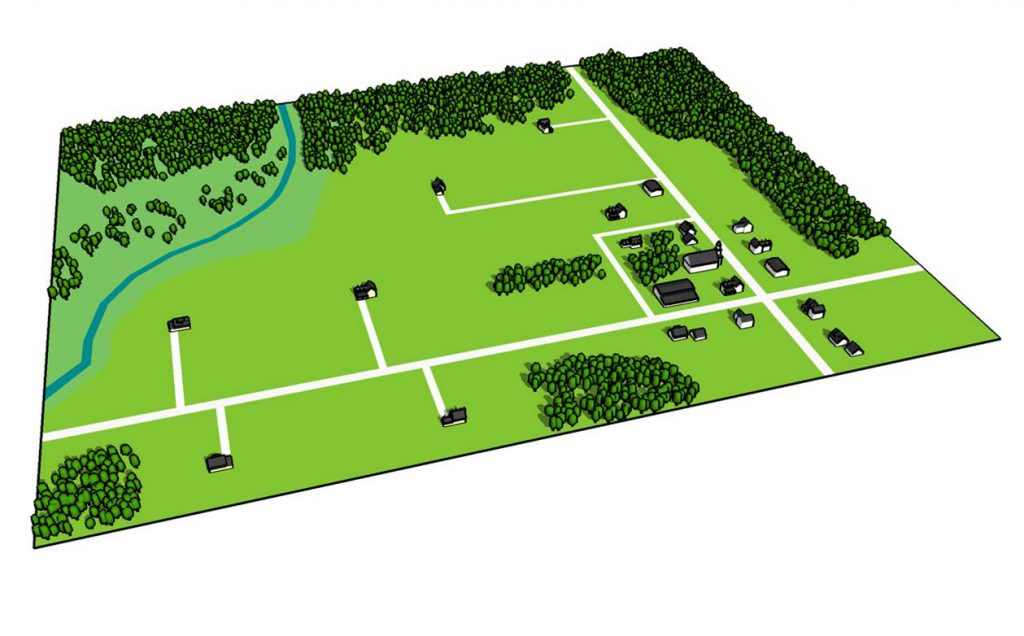
There is a strong connection between access management and development patterns. In areas where frequent curb cuts are allowed with little access planning, road frontages become a clutter of driveways and the development that accompanies them. As access points multiply and development increases, once open and scenic areas can erode into strip development and sprawling patterns of growth. Access management involves more than just limiting those curb cuts, although that is a key provision. It also includes planning for more cohesive and efficient access so that safety and road capacity – as well as scenic road character –are preserved.
Whether you are in a position to create or administer an access management program, or to advocate for management that preserves scenic resources and open areas along road corridors, consider several points:
- Compare goals in comprehensive plans for the region or town with the access-management plans and rules in effect to determine if they are compatible. Without an access-management plan that limits curb cuts, a stated goal such as “preventing strip development” may be unobtainable.
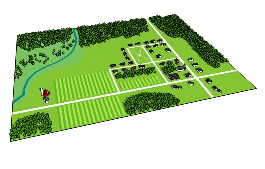
- Consider access management plans that limit curb cuts to one per lot, particularly in areas at risk of strip development. For lots with frontage of more than one road, limit access to the road best suited to handle the traffic generated by the proposed use.
- Require master planning for larger properties with plans for future access and internal roads as part of the plan. A master plan should ensure that earlier stages of development will not impact the ability to connect later stages in an integrated road and access pattern.
- Require shared access between parcels, and the consolidation of existing driveways to reduce the number of accesses.
- Encourage access-management plans to also cover ideas for connector roads and street networks that will reduce the number of access point onto main roads.
Also consider the following policies and standards:
- Driveway width, curve radius, spacing and sight distance
- Shared access
- Service roads and parking lots
- Interconnected street networks
Related Issues
Related Case Studies
Resources
Access Management Guidebook by Elizabeth Humstone and Julie Campoli. Written for the Northwest Regional Planning Commission, St. Albans, VT.
This tool contains supplemental information and detailed case studies related to The Roadscape Guide.
Views to the Mountains: A Scenic Protection Manual provides additional information on ways to control access management to protect scenic byways.