Community overview
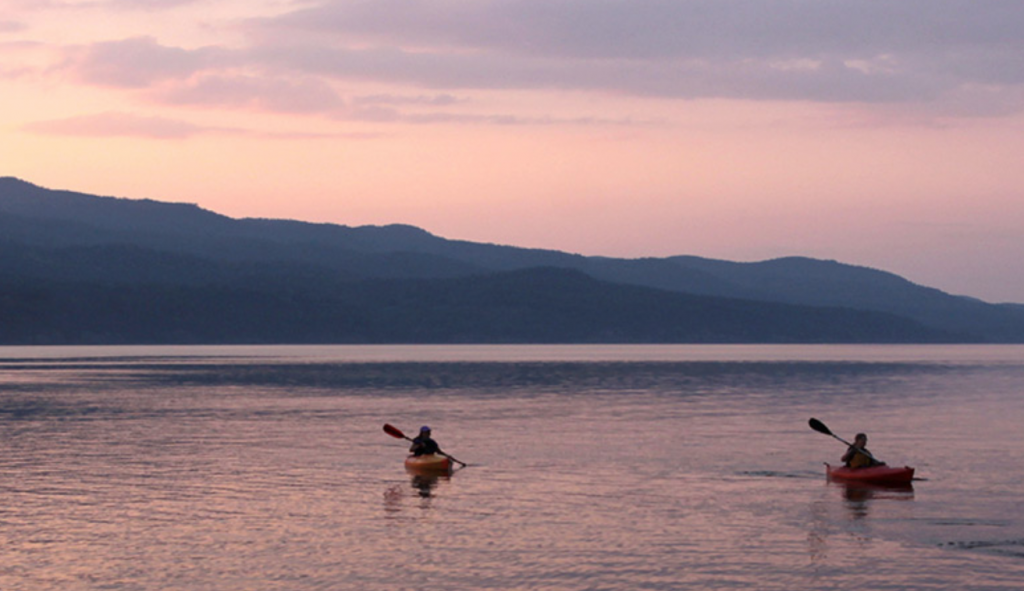
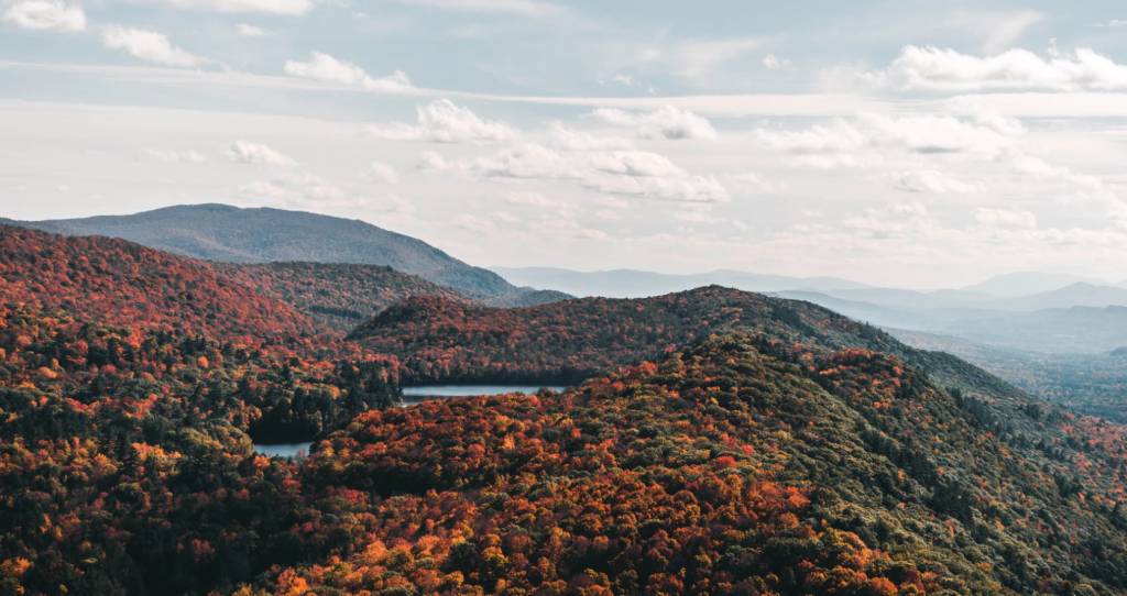
Located between Middlebury and Burlington along the Route 7 Corridor, the nearly 3,500 town residents enjoy the hills and ridges overlooking Lake Champlain. The community is actively engaged in keeping the productive Champlain Valley soils in farming. The result is a variety of agricultural activities that include orchards, dairies, berry farms, a winery, apiaries and community supported agriculture (CSA). Among the community motivations for protecting farmland and open space is maintaining the scenic views along important highway corridors, including Route 7.
Tools you can use
Scenic overlay district – Charlotte
The Champlain Valley Greenbelt Alliance, a non-profit organization, was formed to create greenbelts along major road corridors in Vermont, with an initial focus on the Route 7 corridor from Shelburne to Middlebury. They began by conducting a visual analysis of the Route 7 corridor to determine the strengths of the area – the location of scenic views and gateways to the region’s hamlets and towns, areas appropriate for development and those more suited for protection. Their analysis highlighted the many intact agricultural areas and scenic views in Charlotte. They offered to help draft a scenic overlay district for the Route 7 corridor through Charlotte, and the Town’s Planning Commission agreed to incorporate the draft overlay into the updated zoning bylaws.
Charlotte’s Scenic Overlay District provides additional development review guidelines for building placement within the Route 7 corridor. They determined district boundaries based on topography, views to the mountains on both sides of the road and property boundaries. The Scenic Overlay District and Access Management policies helped change residents and land owners’ expectations, and enabled the community to retain the features of the road that are unique and special.
Lessons Learned
- Be clear on what landscape features your community wishes to protect, and outline the threats to that landscape and objectives of the district.
- When developing district boundaries, ensure that the community’s intent and resource it seeks to protect match what is on the land.
- Ensure that the language is landowner friendly, straightforward and easy to administer.
Related Issues
Related Tools
This case study contains supplemental information related to The Roadscape Guide.