
Community overview
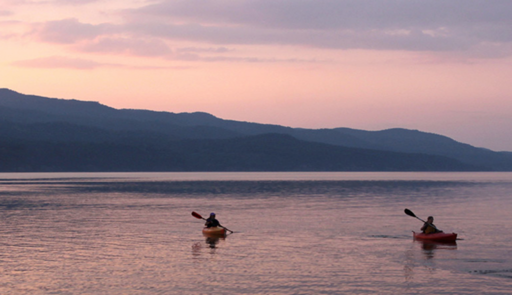
Located between Middlebury and Burlington along the Route 7 Corridor, Charlotte’s nearly 3,500 town residents enjoy the hills and ridges overlooking Lake Champlain. The community is actively engaged in keeping the productive Champlain Valley soils in farming. The result is a variety of agricultural activities that include orchards, dairies, berry farms, a winery, apiaries and community supported agriculture (CSA). Among the community motivations for protecting farmland and open space is maintaining the scenic views along important highway corridors, including Route 7.
Tools you can use
According to the 2006 town survey, many people live in Charlotte because of the open space, natural beauty, rural character, views and the “quiet”. The Town Plan highlights these important town features in its vision for the future. One of the key components of this vision is:
“To maintain and enhance the integrity and continued viability of natural and cultural features with high public value, including prime and statewide agricultural soils, steep slopes, surface and groundwater resources, shoreland buffers, wildlife habitat and other ecologically important natural areas, scenic views and vistas, historic districts, sites and structures, land in active agriculture and conserved land.”
As a result, the town has implemented several tools to ensure that key natural resources, and working forests and farms are protected into the future. In 2006, the town formally adopted conservation developments as one of their Planned Residential Development (PRD) options. Before this time, they were utilizing clustering in order to preserve key resources, but not with the formal, multi-step process as recommended by Randall Arendt (see Tool: Conservation Developments). Also, the current regulations require 50 percent or more of the parcel to be preserved for all developments of four dwelling units or more, regardless of parcel size; whereas the old regulations required open space preservation only on parcels 25 acres or greater.
While the town does not have a formal open space plan, they do have maps that highlight key resources of high public value the town would like to preserve (referenced in Table 7.1 in the Charlotte Land Use Regulations), such as key habitat, wildlife corridors, primary agricultural soils, scenic roads, wetlands, flood hazard areas, historic districts or sites, conserved lands, etc. The maps, which are included in the Town Plan, identify important town features which can be used to create large, contiguous networks of open space and conserved lands.
The planning department recommends that town staff walk an applicant through the conservation development process early on in order to ensure that they are aware of the goals of the town to identify and prioritize key features to be conserved up front and not as an afterthought. Unfortunately, the current workload does not allow Charlotte’s staff to do this for every application. However, staff provides a GIS map to every applicant with important natural, scenic and historic features as listed in Table 7.1 of the Land Use Regulations, which is used as a base map for the applicant’s sketch plans.
Lessons Learned
- You cannot just have the conservation development process and expect the applicant to follow it. Providing one or more maps of key features – both town wide and parcel-specific – will help ensure that everyone is on the same page as the project plans are developed, and have the proposed project configured so as to achieve both the applicant’s development goals and the town’s conservation goals.
- Sit down with the applicant early in the process and make sure they understand the conservation development process, town goals and key features illustrated on any maps that are developed.
Related Issues
Related Tools