
Community overview
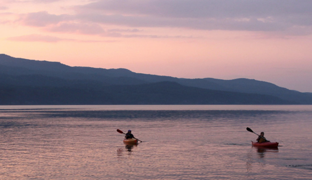
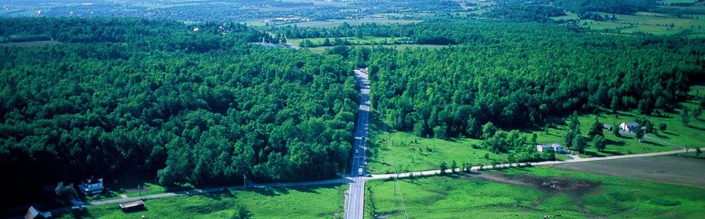
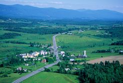
Vermont Route 7 in southern Chittenden and northern Addison Counties passes through rolling Champlain Valley farmland, several small villages, and offers motorists distant views of the Green and Adirondack Mountains. The visual analysis discussed below helped the newly forming Champlain Valley Greenbelt Alliance determine their study area. The communities they chose were facing a comprehensive range of issues facing many towns around the state and represent historic villages, suburban regions and rural areas.
Tools you can use
When the Champlain Valley Greenbelt Alliance (CVGA) formed in 2000, they focused on the changing landscape along the Route 7 corridor. Route 7 winds through many communities and their first step was to determine where to focus their efforts. When discussing boundaries, they considered the geography as well as organizational capacity and the thematic elements that pertained to the newly established organization – in this case land use changes along a road corridor.
A visual analysis was a key first step in helping CVGA to establish boundaries. But instead of sitting in an office, poring over maps, CVGA Board and staff loaded onto a van and set off southbound on Route 7 from Shelburne. Before the trip, everyone had a list of questions to ponder. Once on the trip, participants were asked to describe what they saw as well as articulate their likes and dislikes. They had to describe what changes to the landscape would impact their perceptions. For example if they loved a field, what was good and what would change that perception.
Besides having a wonderful time and sharing a morning cup of coffee, this trip helped set physical boundaries, define the scope of work for their organization and, more importantly, gave the group a common frame of reference for the life of the project. It became the linchpin for future work as they all had a common perception. This would be a important first step for a planning commission, conservation commission or selectboard interested in evaluating a road from an historical or land use perspective.
During their visual analysis, CVGA looked towards the mountains and gave careful consideration to the background view for analysis. They considered the first one or two lots deep along Route 7 beginning in Shelburne and ending in Middlebury. This was within their organizational capacity, and represented a comprehensive range of issues facing many highway corridors around the country as they intended their work to be a model from the beginning. There was suburban sprawl, areas transitioning from a rural landscape with no defined center (New Haven), a more historic center in Ferrisburg and the agricultural land in Charlotte. The area also had a variety of other features including rivers, lakes, forests, and historic villages.
The next step was to map the study area using Geographic Imaging System (GIS) and develop a landscape inventory by layering topography, soils, floodplains, etc. A second map was developed to combine the natural and built landscape and imposed zoning districts, utility corridors, etc on the landscape.
With maps in hand, a defined mission and study area, CVGA then focused on researching the properties – acreage, soils, current use, ownership – and prioritizing their efforts. This ground work allowed them to see patterns – key properties that were “holes” in already preserved greenbelts became a priority or areas where new greenbelts would ensure environmental protection or areas of high scenic qualities. They also looked for areas were the road was closed due to tree canopy or topography that opened to a view. This pattern often became a priority as they are “gateways” of particular interest and often the junction between settlement and the working landscape.
The visual analysis was critical to not only prioritizing areas, but also determining the function the area plays and the best way to develop or conserve it. For example, one property was at high risk for the development of new homes close to Route 7 that would eliminate a significant view. The property owners had already subdivided the land into three lots and one had been purchased and a new home built. Luckily, due to topography and site placement, the house did not obstruct the view. However, the other two lots did not have the same topography and homes on those lots would result in a loss of a key view. Therefore, the best tool was land conservation. In the case of Charlotte, there were areas of high scenic value, but implementing a scenic overlay district, provided a regulatory tool to allow development in a manner that minimized impact.
Lessons Learned
- You cannot be confident that you are applying the right tool until you know what you are looking at. Often, we get so caught up in the tool, that we miss an opportunity to reach our goals.
- The visual analysis enables you to more effectively set priorities and use time and resources efficiently.
- The analysis helped determine which project on which to work, and formed the rational for not working on another project.
- Community involvement can lead to more buy-in, provide the collective wisdom of the group and help re-enforce a common vision.
- It is important to return to the analysis as the landscape is not static – it changes and these changes should be incorporated into your work.
Tip: Consider a visual analysis as a circular, not linear process. While landscape analysis is the “last step,” continue to wrap around and discuss new issues and changes and correlate the trip in the van, with the maps and the historical analysis in order to see patterns emerging.
Related Issue
Related Tool
Resources
- This tool contains supplemental information and detailed case studies related to The Roadscape Guide.
- Views to the Mountains: A Scenic Protection Manual was developed based on the Roadscape Guide for Essex and Jericho. This resource includes detailed information on how to do a scenic roadway assessment and recommendations for regulatory and non-regulatory ways to protect the landscape. It is available in three parts: Part I, Part II, Part III